Atlas of Yellowstone

Summary
The Atlas of Yellowstone presents Yellowstone’s story through maps, data visualizations, photography, and text that is accessible and useful to park visitors and scientists alike.
I was the lead student cartographer for the first edition, creating layouts, maps, and infographics for many sections of the book, including those featured here.
Details
- Designed page layouts in Adobe InDesign.
- Analyzed datasets primarily in Microsoft Excel.
- Imported, analyzed, and arranged geospatial data in ArcGIS, with some supporting software for things like complex remote sensing data. Exported data into formats that could be brought into Adobe Photoshop and Illustrator.
- Created maps and infographics in Illustrator, with Photoshop used to create background raster imagery (shaded relief, satellite imagery, remote sensing data).
- Edited text with input from subject matter experts (researchers and National Park Service staff).


Other Projects
Design at Yellowstone National ParkCartography, Print Design, Digital Design, Multimedia, Social Media
Design at Rocky Mountain National ParkCartography, Print Design, Digital Design, Multimedia, Social Media

Iconic National Park Service MapsCartography, Infographics, Design
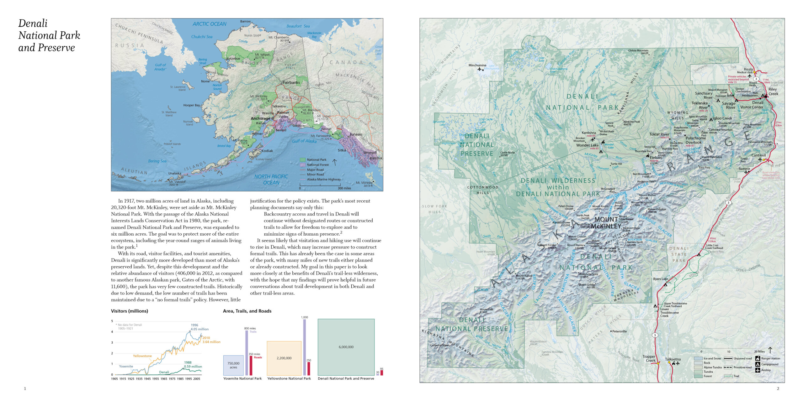
The Value of Trail-less Places: DenaliCartography, Infographics, Writing/Editing, Photography, Book Design