Iconic National Park Service Maps
Harpers Ferry Center
National Park Service
U.S. Department of the Interior
Death Valley National Park

Summary
I was one of a handful of cartographers in the US National Park Service's Unigrid Brochure Program, housed at the Harpers Ferry Center for Media Services.
While there, I created maps, bird's-eye views, infographics, and brochure designs for hundreds of park brochures, including over two dozen new designs.
Details
Every brochure project was unique, from the National Park Service staff I collaborated with at each site to the specifics of each design. Yet each was also part of a recognizable whole, both through the brilliance of Massimo Vignelli's 1977 Unigrid design system and the NPS's strong cartographic tradition.
I was incredibly lucky that my time at HFC overlapped with the tenure of Tom Patterson, one of the premiere cartographers of the modern era.
- Designed brochure layouts in Adobe InDesign.
- Imported, analyzed, and arranged geospatial data in ArcGIS, Natural Scene Designer.
- Created maps, bird's-eye views, and infographics in Illustrator and Photoshop using Avenza's MAPublisher and Geographic Imager plugins, and, occasionally, 3D programs like Blender and Maya.
Rocky Mountain National Park

Capital Reef National Park

Capital Reef National Park Block Diagram

Lake Meade National Recreation Area
")
Point Reyes National Seashore

Golden Gate National Recreation Area
")
Golden Gate National Recreation Area
")
Isle Royale National Park
")
White Sands National Park

Big Hole National Battlefield

Other Projects
Design at Yellowstone National ParkCartography, Print Design, Digital Design, Multimedia, Social Media
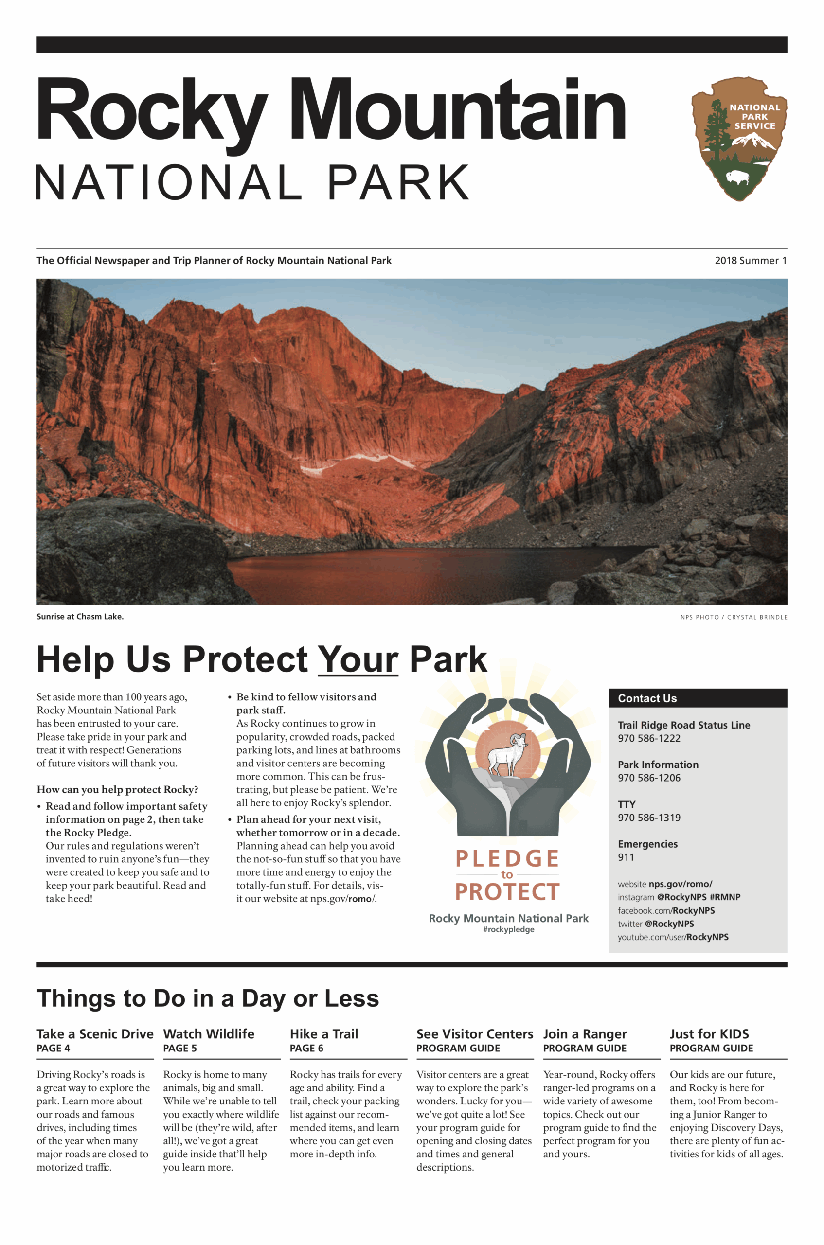
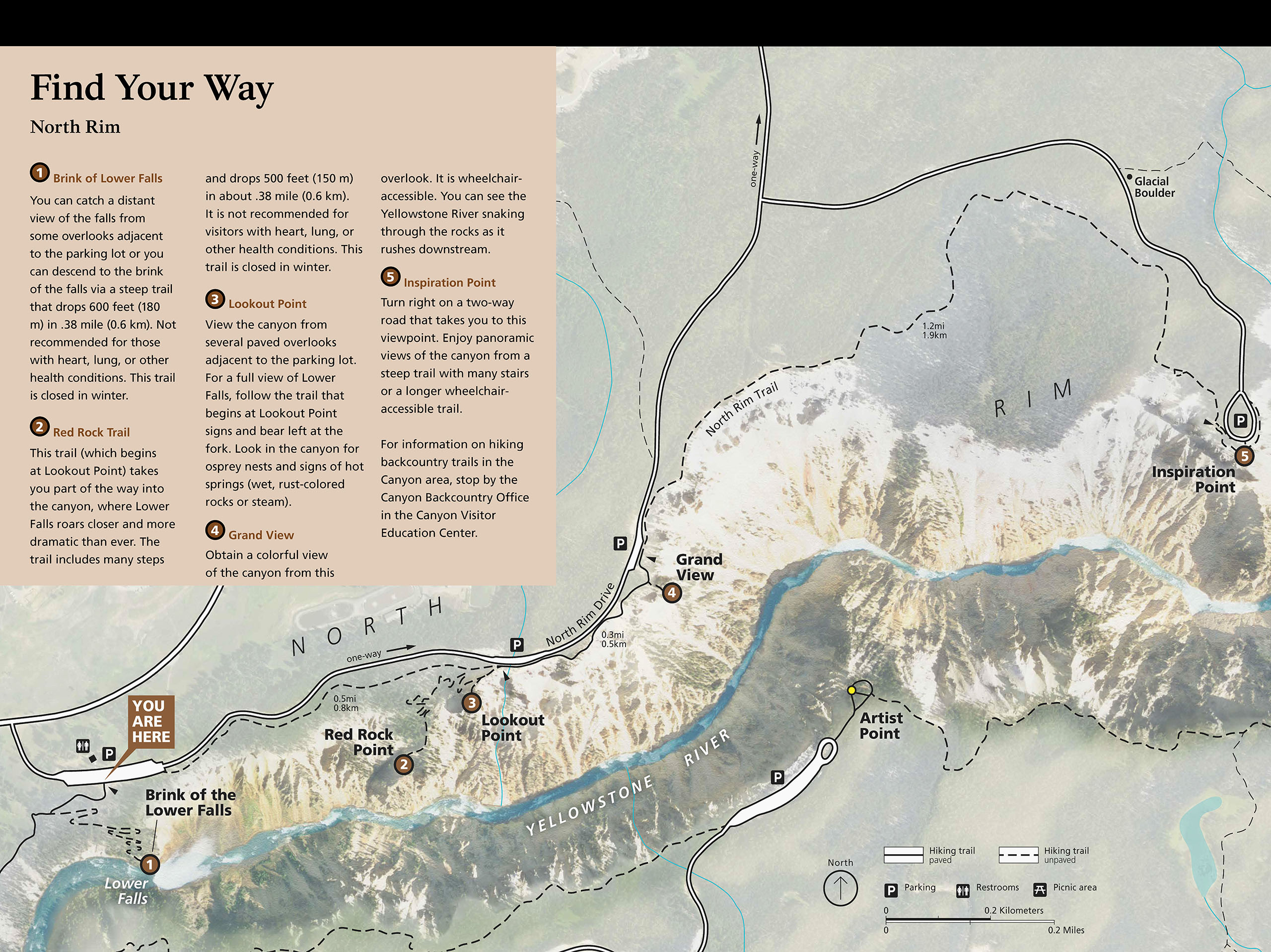
Design at Rocky Mountain National ParkCartography, Print Design, Digital Design, Multimedia, Social Media
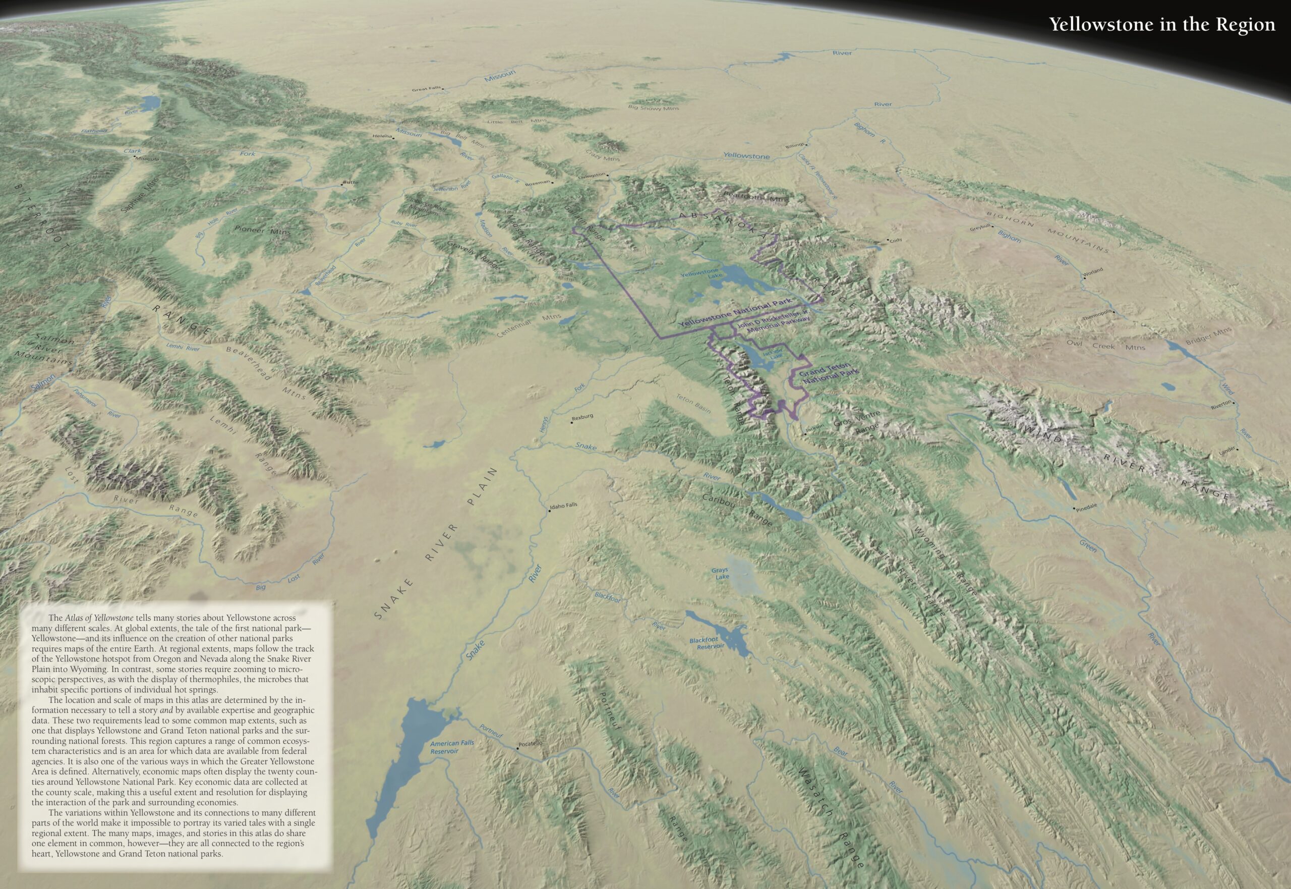
Atlas of YellowstoneCartography, Infographics, Writing/Editing, Book Design
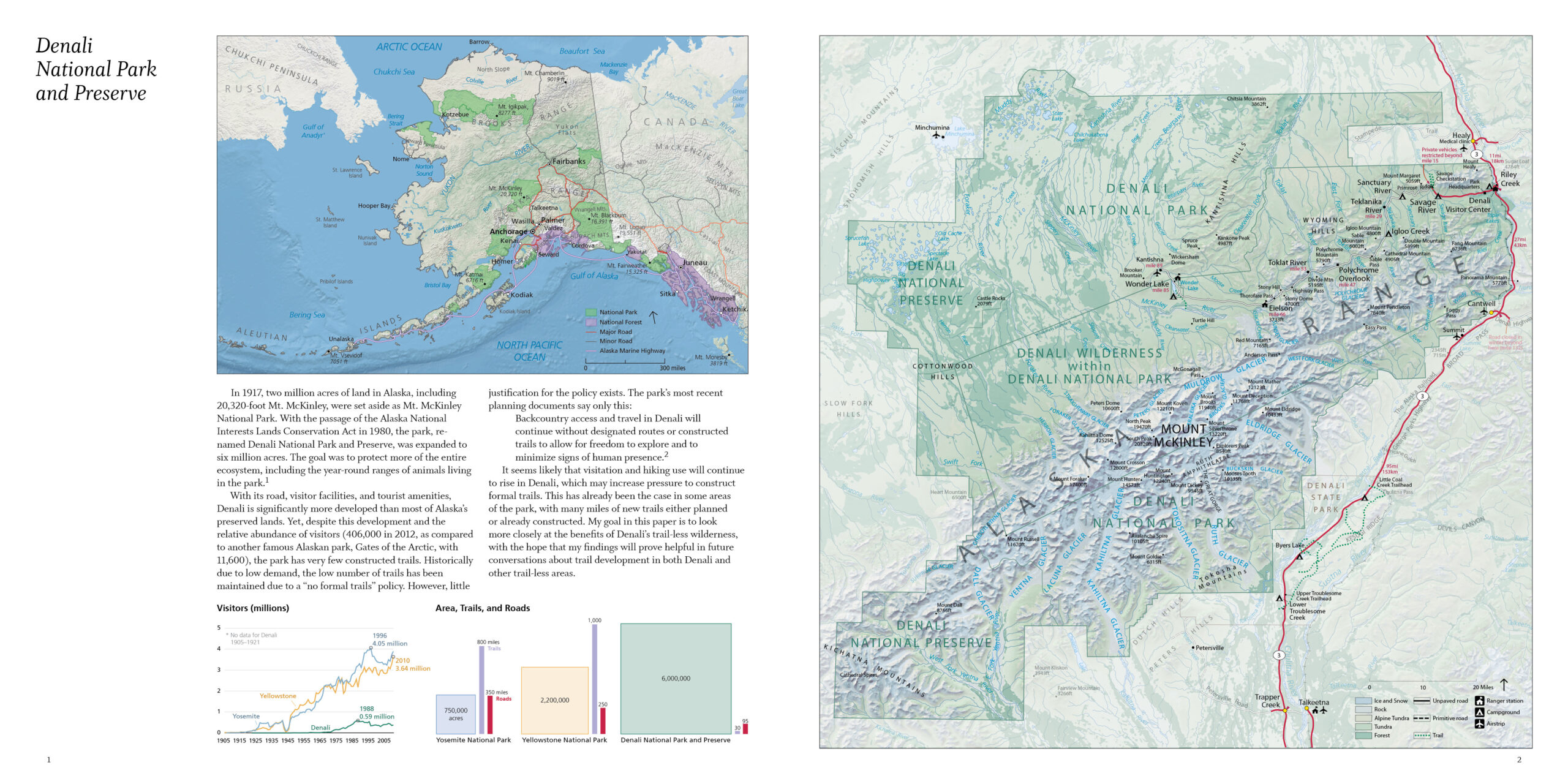
The Value of Trail-less Places: DenaliCartography, Infographics, Writing/Editing, Photography, Book Design